VERTICAL CONTINENTAL MOVEMENT
By Jack Coles
For whatever reason, the rapid cataclysmic vertical continental change caused by massive earthquakes is a topic often refused by scientists as an area of legitimate study. However, this change can be observed taking place in a matter of minutes, days, or over the course of a few years.
Scientists will tell you that the continents are riding on top of convection currents of hot rock. This molten material causes the uplifting and recession of the continental plates. One of the motions involved, called subduction is the action or process of the edge of one coastal plate descending below the edge of another. And another called strike-slip faulting at plate boundaries is when one plate is moving in an opposite direction of the other. These scientific phenomena have consequently raised the question, “Will California one day sink or break off and tumble into the Pacific Ocean”?
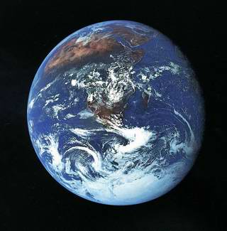
It is a question which is beyond the scope of our limited knowledge and understanding at this time, but one thing we can say with extreme certainty: there are notable earth changes on every part of the globe, from the depths of the seven seas to the heights of the mountains.
For instance, Mount Everest is the tallest mountain on the planet. One interesting fact about this mountain is that sea floor material has been discovered at its very top. Many scientists however, believe that the simple adage, “what goes up must come down”, does not apply to this particular situation which exists on Mount Everest, or that the change would take eons, if at all.
It is thought that the most seismically active coastlines are on a stable elevation, or possibly on their way up from the sub ducting sea floor which runs underneath the lip of the continent. The possibility that coastlines on any continent could move suddenly up or down vertically is not only politically incorrect, it is promoted by high science as an event which could only take place over the course of thousands, if not millions of years. The transmitted thought is to buy ocean front property without risk.
The fact is, however, that up and down vertical motion has been recorded many times, albeit on a small scale in recent history. Large earthquakes cause ground undulation and this in turn causes coastlines to elevate and recede. Like a throw rug which is stepped on incorrectly, ripples like a stone thrown in a pond undulate outward from the impact area. The water in the pond eventually flattens out. However, on the throw rug, the ripples remain. This elementary process has been demonstrated by flat-pan sand models used in scientific experiments to determine surface wave patterns. This also happens when seismic energy stops in a large earthquake. When the energy ceases, ground levels may be in completely different positions than they were before the quake occurred.
Consider as an example of this dislocation the 1964 Good Friday Alaska earthquake. The ground undulation there caused a housing tract and business area, which had been built on flat land, to end up as rolling hills as high as two stories. Some of the houses were at forty-five degree angles after the quake. Subsequently this area was turned into Earthquake Park, Anchorage, Alaska.
Believe it or not, the first time I thought that continents could rise or fall in a rapid period of time was when I was in the third grade. My teacher showed us a newly compacted sandstone with a seashell embedded in it. She then pulled the shell away from the fragile sandstone developing rock and showed us a fossil underneath. She explained that she had found this fossil while hiking in the east foothills of Silicon Valley, which were no more than 200 yards from our classroom.
Pointing to an outcropping of rock about ninety feet above sea level, she continued by saying that Native Americans had fished from the foothills only a few hundred years ago and had thrown the remains of shellfish into a common spot. This garbage dump later sank into the sea shore sand. She then explained that sea sand was eroding away all along the ridge and that this particular outcropping was only being held together by the cluster of seashells. This extraordinary teacher concluded by saying that the Native American history included their folklore a time when California had been a set of islands and that this upper shoreline was proof of it. Just a few days later, I found myself in another class being taught by another teacher who held a completely different viewpoint. This teacher told us that it took about 15,000 years to form the Silicon Valley. The shell had looked too pristine to me to be that old. Even then, I thought it to be no more than a couple of thousand years in age.
Here I was, eight years old and already questioning one teacher over another. Even if it took 15,000 years, the main shoreline goes down to its present level without a noticeable large shoreline in between. It seemed to me then, and still does today, that there had to be a sudden vertical change occurring over a short period of time. Or, has someone carried the heavy sand and the shells up from the bay? Not likely!
The current scientific community does not support any of these conclusions. The idea of a temporary shoreline existing 90 feet above the present sea level simply does not compute in any of their timelines to recent history. However, in the 1980’s, the valley floor was excavated thirty feet down into the top soil, adobe clay, and native artifacts, which dated back 20 to 30 thousand years. These artifacts were found below sea level. Also, the many levels of dirt and clay revealed that flooding had occurred numerous times over the centuries. Is it not possible that many shorelines at various elevations have eroded into the valley floor below?
I have a Native American elder friend, whom I have spoken of earlier, who tells of a time when the earth moved up and down in a very short period of time. He has stated that the occurrence of one particular event is included in the oral histories of many tribes. It goes something like this: One day the Great Chief (He called him Grandfather), had taught all his children everything that they could learn, so he left and traveled off across the waters to play with the animals. They believed that when Grandfather returns, so will the upper shorelines. This elder also said that this “circle” (or cycle) has happened before.
Today there is solid evidence that this vertical up and down motion has happened on a smaller scale. For instance, in Naples, Italy, after a volcano showed sighs of eruptions and quakes, ground which had been many feet under the seashore rose, exposing a building that had been hidden beneath the water. In addition to this, the shoreline at Olema moved about a mile away from its docks during the 1906 Great Earthquake in San Francisco, California.
The fact that I believe that earthquakes can and do cause the rapid uplifting and recession of the ground, does not mean that I’m suggesting or predicting this dramatic vertical motion will take place any time soon. What I am saying is that, due to the current scientific history which we possess, we need to prepare ourselves and be ready for anything. Please remember that the Los Angeles basin is built upon hundreds of layers of sea sediment which go down quite far into the earth. This is evident all over the West Coast of North America.
Finally, there is an ancient record, not included in our scientific record, which puts a vertical catastrophic change in the near future.
Come burning cities or high water, I hope you and your children are ready….
Stay Safe, Be Ready
Postcript: Just after making the first draft of this letter, the area mentioned as the “outcropping rock” when I was in the third grade shook with a 5.6 magnitude quake at Alum Rock Park, five miles northeast of San Jose, California. This was the first 5.6 since the October 17, 1989 Loma Prieta 7.2 magnitude World Series earthquake… Twenty-four hours before this 5.6 magnitude quake, a strange 180 mile long weather system ran parallel to the San Andreas Fault with lightning, heavy hail and rain. (See “Weather or Not”)